GUTSCHEIN
Bitte haben Sie einen Moment Geduld, wir legen Ihr Produkt in den Warenkorb.
Diese Produkte könnten Sie auch interessieren:
Bitte haben Sie einen Moment Geduld, wir legen Ihr Produkt in den Warenkorb.
| Reihe | Collins Road Atlas |
|---|---|
| Themen | Lifestyle, Hobbys und Freizeit Reisen und Urlaub Reiseführer |
| ISBN | 9780008779061 |
| Sprache | Englisch |
| Erscheinungsdatum | 12.03.2026 |
| Größe | 131 x 227 mm |
| Verlag | HarperCollins Publishers |
| Lieferzeit | Lieferung innerhalb von 28 Werktagen |
| Herstellerangaben | Anzeigen Product Safety Manager enquiries@harpercollins.ie |
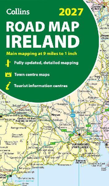
Explore Ireland with easy-to-read mapping from Collins.Full-colour map of Ireland at 9 miles to 1 inch (1:570,240), with clear, detailed road network and counties and new administrative areas shown in colour. This double-sided map covers the whole of Ireland, and is ideal for reference or route planning.This map of Ireland shows the road network in detail. It is ideal for business users, with colouring of local council areas, but it is also perfect for tourists as a route planning map.Main features include:- Fully updated- New administrative areas shown in colour- Clear, detailed road network- Town and city names, rivers, lakes, spot heights, railway lines and canals are clearly shown- City/town centre street plans of Belfast, Cork, Dublin, Dún Laoghaire, Galway, Limerick, Londonderry/Derry and Waterford showing places of interest- Full index to place names- Mileage chart- Car ferry routes- Key in English, French and GermanArea of coverageCovers the whole of the Republic of Ireland and Northern Ireland
| Reihe | Collins Road Atlas |
|---|---|
| Themen | Lifestyle, Hobbys und Freizeit Reisen und Urlaub Reiseführer |
| ISBN | 9780008779061 |
| Sprache | Englisch |
| Erscheinungsdatum | 12.03.2026 |
| Größe | 131 x 227 mm |
| Verlag | HarperCollins Publishers |
| Lieferzeit | Lieferung innerhalb von 28 Werktagen |
| Herstellerangaben | Anzeigen Product Safety Manager enquiries@harpercollins.ie |
Wie gefällt Ihnen unser Shop?
