GUTSCHEIN
Bitte haben Sie einen Moment Geduld, wir legen Ihr Produkt in den Warenkorb.
Diese Produkte könnten Sie auch interessieren:
Bitte haben Sie einen Moment Geduld, wir legen Ihr Produkt in den Warenkorb.
| Reihe | A -Z Adventure Series |
|---|---|
| Themen | Lifestyle, Hobbys und Freizeit Reisen und Urlaub Landkarten und Atlanten Reise- und Freizeitkarten |
| ISBN | 9780008780531 |
| Sprache | Englisch |
| Erscheinungsdatum | 23.04.2026 |
| Größe | 233 x 130 mm |
| Verlag | HarperCollins Publishers |
| Lieferzeit | Lieferung innerhalb von 28 Werktagen |
| Herstellerangaben | Anzeigen Product Safety Manager enquiries@harpercollins.ie |
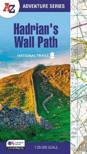
The A-Z Adventure Series of maps combines the best of OS and A-Z, creating the perfect companion for walkers, off-road cyclists, horse riders and anyone wishing to explore the great outdoors.Hadrian's Wall Path is a National Trail which follows the line of Hadrian's Wall from coast-to-coast. The 84 mile (135km) path weaves through beautiful countryside, encountering historic remains of Roman forts and milecastles, splendid bridges, views from the Whin Sill escarpment and Solway salt marshes. Starting in Wallsend in Newcastle and ending in Bowness-on-Solway, the route on the map is clearly highlighted in yellow with mileage markers added to gauge distances when planning sections of the walk to enjoy.This National Trail Map of Hadrian's Wall Path features 38 pages of continuous Ordnance Survey 1:25 000 mapping, providing complete coverage of the Hadrian's Wall Path. The atlas includes a route planner showing distances between places and the amenities available, featuring:¿Information Centres¿Hotels/B&Bs¿Youth Hostels¿Campsites (seasonal opening)¿Pubs, shops, restaurants, and cafes (seasonal opening)¿Petrol StationsAlso featured is advice on safety and security when walking and the Countryside Code.Unlike the original OS sheets, this A-Z Adventure Atlas includes a comprehensive index to towns, villages, hamlets and locations, natural features, nature reserves, car parks and youth hostels, making it easy to find the required location quickly. Each index entry has a page reference and a six figure National Grid Reference. With a book size of 240mm x 134mm it is the same size as the standard folded OS map.Other National Trails available within the A-Z Adventure series include: Cotswold Way, Pembrokeshire Coast Path, South Downs Way, SW Coast Path,and Thames Path.
| Reihe | A -Z Adventure Series |
|---|---|
| Themen | Lifestyle, Hobbys und Freizeit Reisen und Urlaub Landkarten und Atlanten Reise- und Freizeitkarten |
| ISBN | 9780008780531 |
| Sprache | Englisch |
| Erscheinungsdatum | 23.04.2026 |
| Größe | 233 x 130 mm |
| Verlag | HarperCollins Publishers |
| Lieferzeit | Lieferung innerhalb von 28 Werktagen |
| Herstellerangaben | Anzeigen Product Safety Manager enquiries@harpercollins.ie |
Wie gefällt Ihnen unser Shop?
