GUTSCHEIN
Bitte haben Sie einen Moment Geduld, wir legen Ihr Produkt in den Warenkorb.
Diese Produkte könnten Sie auch interessieren:
Bitte haben Sie einen Moment Geduld, wir legen Ihr Produkt in den Warenkorb.
| ISBN | 9781566955799 |
|---|---|
| Sprache | Englisch |
| Erscheinungsdatum | 01.01.2020 |
| Größe | 233 x 108 mm |
| Verlag | National Geographic Maps |
| Lieferzeit | Lieferung innerhalb von 28 Werktagen |
| Herstellerangaben | Anzeigen Libri GmbH Europaallee 1 | D-36244 Bad Hersfeld gpsr@libri.de |
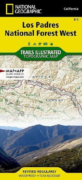
- Waterproof - Tear-Resistant - Topographic MapLos Padres National Forest contains a wide range of ecosystems, from seacoast and marine habitats to redwood forests, mixed conifer forests, oak woodlands, grasslands, pinyon juniper stands, chaparral and semi-desert areas, which are home to more than 486 fish and wildlife species. Explore this diverse and scenic region in detail with National Geographic's Trails Illustrated map of Los Padres National Forest West.- Created in partnership with local land management agencies, this expertly researched map highlights many key areas of interest including Gaviota State Park; Pismo, Refugio and El Capitan state beaches; Lake Cachuma; Chumash Painted Cave State Historic Park; Sisquoc Wild and Scenic River; Oceano Dunes State Vehicular Recreation Area; and Santa Margarita Lake Regional Park.- This map can guide you off the beaten path and back again with miles of mapped trails including trails for hiking and horseback riding, as well as ATV and motorcycle use.- The San Marcos Pass Road and San Luis Obispo North Coast scenic byways are noted for those wishing to take in the scenery by car.Many recreation features are noted as well, including campgrounds, trailheads, OHV staging areas, horse camps, Frisbee golf, boat launches, and fishing, windsurfing, and swimming areas. The map base includes contour lines, shaded relief, and elevations for summits, passes, and many lakes.Every Trails Illustrated map is printed on "Backcountry Tough" waterproof, tear-resistant paper. A full UTM grid is printed on the map to aid with GPS navigation.Other features found on this map include: Arroyo Grande, Avila Beach, Buellton, Cuyama River, Gaviota, Goleta, Irish Hills, La Panza Range, Lake Cachuma, Las Cruces, Los Alamos, Los Olivos, Nipomo, Oceano, Pismo Beach, Point San Luis, Purisima Hills, San Luis Obispo, San Luis Obispo Bay, San Luis Obispo County, San Rafael Mountains, Santa Barbara County, Santa Margarita, Santa Margarita Lake, Santa Ynez, Sierra Madre Mountains, Sisquoc River, Solvang, Tajiguas, Timber Peak.- Map Scale = 1:80,000- Sheet Size = 25.5" x 37.75"- Folded Size = 4.25" x 9.25"
| ISBN | 9781566955799 |
|---|---|
| Sprache | Englisch |
| Erscheinungsdatum | 01.01.2020 |
| Größe | 233 x 108 mm |
| Verlag | National Geographic Maps |
| Lieferzeit | Lieferung innerhalb von 28 Werktagen |
| Herstellerangaben | Anzeigen Libri GmbH Europaallee 1 | D-36244 Bad Hersfeld gpsr@libri.de |
Wie gefällt Ihnen unser Shop?
