GUTSCHEIN
Bitte haben Sie einen Moment Geduld, wir legen Ihr Produkt in den Warenkorb.
Diese Produkte könnten Sie auch interessieren:
Bitte haben Sie einen Moment Geduld, wir legen Ihr Produkt in den Warenkorb.
| ISBN | 9781566959223 |
|---|---|
| Sprache | Englisch |
| Erscheinungsdatum | 21.03.2024 |
| Größe | 238 x 109 mm |
| Verlag | National Geographic Maps |
| Lieferzeit | Lieferung innerhalb von 28 Werktagen |
| Herstellerangaben | Anzeigen Libri GmbH Europaallee 1 | D-36244 Bad Hersfeld gpsr@libri.de |
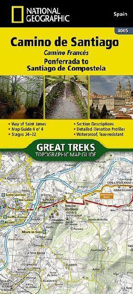
- Waterproof - Tear-Resistant - Topographic MapThe Way of Saint James, known in Spanish as Camino de Santiago -- or simply El Camino (The Way) -- has been one of Europe's most iconic walking routes since 9th century pilgrims began making their way to the Cathedral of Santiago de Compostela to venerate the remains of Saint James. Though rooted in Christian tradition, the route has been reborn as a nondenominational spiritual rite and epic long distance trail that runs along Roman roads, across mountains, and through picturesque countryside and historic towns.- The Ponferrada to Santiago de Compostela Topographic Map Guide booklet makes a perfect traveling companion when traversing the last section of the Camino Francés (French Route).- This section of the trail includes the final 100km required to receive the famous Compostela pilgrim certificate when arriving in Santiago.- This final booklet includes sections 24-32.- A detailed description of each trail section is included that tells travelers about the many landmarks encountered along the way.- Each Camino de Santiago Topographic Map Guide includes detailed topographic maps of 2 cm = 1 km.- Each page is centered on the trail and overlaps with the adjacent pages so there is little chance of getting lost.Along the bottom of each page is a trail profile that shows the distance between towns, rest houses, and trail access points. The map and trail profile provide a step by step visual guide to hiking the trail.Every Great Treks map is printed on "Backcountry Tough" waterproof, tear-resistant paper. A full Lat/Long grid is printed on the map to aid with GPS navigation. Every map purchase helps support the National Geographic Society, an impact driven, nonprofit organization with global reach that uses the power of science, exploration, education, and storytelling to illuminate and protect the wonder of our world.- Map Scale = 1:50,000- Folded Size = 4.25" x 9.38"
| ISBN | 9781566959223 |
|---|---|
| Sprache | Englisch |
| Erscheinungsdatum | 21.03.2024 |
| Größe | 238 x 109 mm |
| Verlag | National Geographic Maps |
| Lieferzeit | Lieferung innerhalb von 28 Werktagen |
| Herstellerangaben | Anzeigen Libri GmbH Europaallee 1 | D-36244 Bad Hersfeld gpsr@libri.de |
Wie gefällt Ihnen unser Shop?
