GUTSCHEIN
Bitte haben Sie einen Moment Geduld, wir legen Ihr Produkt in den Warenkorb.
Diese Produkte könnten Sie auch interessieren:
Bitte haben Sie einen Moment Geduld, wir legen Ihr Produkt in den Warenkorb.
| Reihe | Americana |
|---|---|
| Themen | Kinder, Jugendliche und Bildung Nachschlagewerke Nachschlagewerke: Atlanten und Karten |
| ISBN | 9781847807113 |
| Sprache | Englisch |
| Erscheinungsdatum | 01.10.2015 |
| Größe | 347 x 288 mm |
| Verlag | Quarto Publishing PLC |
| Empf. Lesealter | ab 7 bis 10 Jahre |
| Illustrationen | Sol Linero |
| Lieferzeit | Lieferung innerhalb von 28 Werktagen |
| Herstellerangaben | Anzeigen office@wts-tax.si |
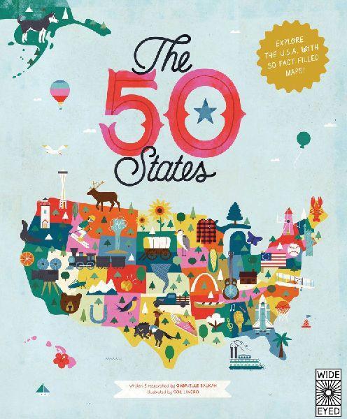
Explore every state of the USA from Alabama to Wyoming with these 51 charmingly illustrated infographic maps! Includes an expansive guide to the state flags and US presidents.Discover more than 2,000 facts about the people, cities, nature and historic events that have helped make America what it is today. Ghost towns, swamp tours, the center of the universe… bacon donuts, brainy berries, salmon jerky… The French Fry King, The Mother of Oregon, The Queen of Blues… be inspired by the inventiveness, beauty and diversity of our great nation in this curious collection of fact-filled maps.On each weird and wonderful map, find:- A welcome box with a short introduction to the state- Key facts, including the capital; state bird, flower and tree; and statehood order- State icons celebrating the state’s people, places and history- Six inspiring people who have a connection to the state- Region spotlight bubbles to allow you to discover more about one particular place- A moments to remember box with a list of significant dates and their events in the state’s historyEach state’s map also contains information about which states it neighbors, its bodies of water and borders as well as where it is situated in the country. Did you know that while Hawaii shares its border with no one, both Missouri and Tennessee border eight other states? Many state parks, battlefields, national forests and reservations are also included to inspire you to explore the great outdoors.So pack your bags and say later ‘gator… the great States await! The 50 States series of books for young explorers celebrates the USA and the wider world with key facts and fun activities about the people, history and natural environments that make each location within them uniquely wonderful. Beautiful illustrations, maps and infographics bring the places to colorful life.Also available in this series:50 Adventures in the 50 States, 50 Trailblazers of the 50 States, Only in America, Only in California, Only in Texas, We Are the United States, and a wide range of activity books.
| Reihe | Americana |
|---|---|
| Themen | Kinder, Jugendliche und Bildung Nachschlagewerke Nachschlagewerke: Atlanten und Karten |
| ISBN | 9781847807113 |
| Sprache | Englisch |
| Erscheinungsdatum | 01.10.2015 |
| Größe | 347 x 288 mm |
| Verlag | Quarto Publishing PLC |
| Empf. Lesealter | ab 7 bis 10 Jahre |
| Illustrationen | Sol Linero |
| Lieferzeit | Lieferung innerhalb von 28 Werktagen |
| Herstellerangaben | Anzeigen office@wts-tax.si |
Wie gefällt Ihnen unser Shop?
