GUTSCHEIN
Bitte haben Sie einen Moment Geduld, wir legen Ihr Produkt in den Warenkorb.
Diese Produkte könnten Sie auch interessieren:
Bitte haben Sie einen Moment Geduld, wir legen Ihr Produkt in den Warenkorb.
| Reihe | Philip's Street Atlas |
|---|---|
| Themen | Lifestyle, Hobbys und Freizeit Reisen und Urlaub Landkarten und Atlanten Reise- und Freizeitkarten |
| ISBN | 9781849076319 |
| Sprache | Englisch |
| Erscheinungsdatum | 06.07.2023 |
| Größe | 267 x 185 mm |
| Verlag | Octopus Publishing Group |
| Lieferzeit | Lieferung innerhalb von 28 Werktagen |
| Herstellerangaben | Anzeigen Hachette Ireland info@hbgi.ie |
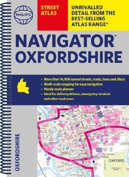
The only county Street Atlas with all the named streets of Oxfordshire and perfect back-up for emergency services, delivery drivers, visitors and locals.With more than 11,000 named streets, roads, lanes and alleys, this is the essential map book for residents and visitors - especially if you're in a hurryIncludes all the streets in ABINGDON-ON-THAMES, BANBURY, BICESTER, DIDCOT, HENLEY-ON-THAMES, KIDLINGTON, OXFORD, THAME, WITNEY, Adderbury, Benson, Burford, Carterton, Caversham, Chalgrove, Charlbury, Chinnor, Chipping Norton, Cholsey, Cowley, Cumnor, Eynsham, Faringdon, Goring, Grove, Headington, Highworth, Kennington, Lechlade-on-Thames, Middleton Cheney, Pangbourne, Sonning Common, Stokenchurch, Wallingford, Wantage, Wargrave, Watlington, Wheatley, Woodstock, Wootton.- New completely revised edition in practical spiral-bound format- Street maps show car parks, schools, hospitals and many other places of interest, including off the beaten track- Information on the ZEZ and other zones- 2-page practical route-planning section showing all A and B roads- Super-clear mapping- Easy-to-use index- Scales: 3¿ inches to 1 mile (1:18,000). Oxford: 7 inches to 1 mile (1:9,000).Other information on the maps includes postcode boundaries, car parks, railway and bus stations, post offices, schools, colleges, hospitals, police and fire stations, places of worship, leisure centres, footpaths and bridleways, camping and caravan sites, golf courses, and many other places of interest.
| Reihe | Philip's Street Atlas |
|---|---|
| Themen | Lifestyle, Hobbys und Freizeit Reisen und Urlaub Landkarten und Atlanten Reise- und Freizeitkarten |
| ISBN | 9781849076319 |
| Sprache | Englisch |
| Erscheinungsdatum | 06.07.2023 |
| Größe | 267 x 185 mm |
| Verlag | Octopus Publishing Group |
| Lieferzeit | Lieferung innerhalb von 28 Werktagen |
| Herstellerangaben | Anzeigen Hachette Ireland info@hbgi.ie |
Wie gefällt Ihnen unser Shop?
