GUTSCHEIN
Bitte haben Sie einen Moment Geduld, wir legen Ihr Produkt in den Warenkorb.
Diese Produkte könnten Sie auch interessieren:
Bitte haben Sie einen Moment Geduld, wir legen Ihr Produkt in den Warenkorb.
| Reihe | Philip's Street Atlas |
|---|---|
| Themen | Lifestyle, Hobbys und Freizeit Reisen und Urlaub Landkarten und Atlanten Straßenverzeichnisse, Stadtpläne oder -atlanten |
| ISBN | 9781849076456 |
| Sprache | Englisch |
| Erscheinungsdatum | 18.01.2024 |
| Größe | 200 x 269 mm |
| Verlag | Octopus Publishing Group |
| Lieferzeit | Lieferung innerhalb von 28 Werktagen |
| Herstellerangaben | Anzeigen Hachette Ireland info@hbgi.ie |
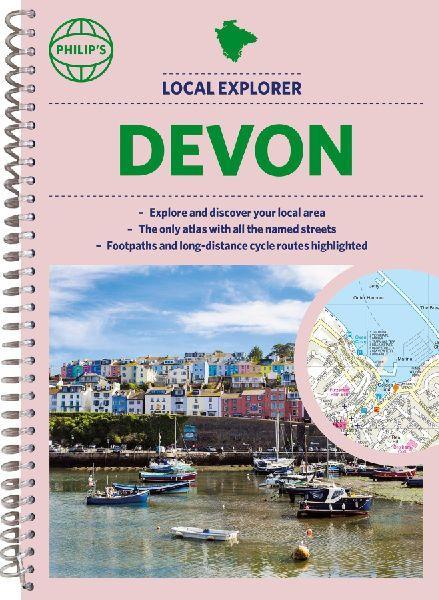
Philip's created this new series for walkers, cyclists and local explorers at a scale that provides greener options to uncover all the nature and hidden gems in your local area. From Barnstaple to Totnes, we cover Devon in exceptional detail.Who hasn't explored and enjoyed their surrounding area in recent years and come to appreciate what is on our respective doorsteps? Philip's have created this new series for walkers, cyclists and local explorers at a scale that provides greener options to uncover all the nature and hidden gems in your local area.Includes all the 28,000 streets in BARNSTAPLE, EXETER, EXMOUTH, PAIGNTON, PLYMOUTH, TORQUAY, Appledore, Axminster, Bideford, Brixham, Buckfastleigh, Crediton, Dartmouth, Dawlish, Great Torrington, Honiton, Ilfracombe, Ivybridge, Kingsbridge, Newton Abbot, Okehampton, Salcombe, Seaton, Sidmouth, South Molton, Tavistock, Teignmouth, Tiverton, Totnes... and every town and village.The detailed scale allows explorers, walkers and cyclists to avoid main roads and select pathways, bridleways and lanes for optimum enjoyment. Whether it's meandering through the local parks or historic houses, exploring neighbourhood nature spots or the local town, we have the clear mapping and information you need.If you do have to travel to reach areas you'd like to explore, all A and B roads are clearly shown on our Route Planner and we include all the large-scale town and city plans. Exceptional detail allows the user to pinpoint exactly where they need to go and the best route to follow.· The only atlas with every road, street and lane in the county named, along with the best pedestrian routes, long-distance cycle routes.· Highlighting lanes, alleyways, footpaths and bridleways, camping and caravan sites, golf courses, parks, gardens and many, many other places of interest.· Contains all the usual one-way streets, barriers, car parks, railway and bus stations, hospitals, colleges and schools, police and fire stations, places of worship, post offices, shopping and leisure centres.
| Reihe | Philip's Street Atlas |
|---|---|
| Themen | Lifestyle, Hobbys und Freizeit Reisen und Urlaub Landkarten und Atlanten Straßenverzeichnisse, Stadtpläne oder -atlanten |
| ISBN | 9781849076456 |
| Sprache | Englisch |
| Erscheinungsdatum | 18.01.2024 |
| Größe | 200 x 269 mm |
| Verlag | Octopus Publishing Group |
| Lieferzeit | Lieferung innerhalb von 28 Werktagen |
| Herstellerangaben | Anzeigen Hachette Ireland info@hbgi.ie |
Wie gefällt Ihnen unser Shop?
