GUTSCHEIN
Bitte haben Sie einen Moment Geduld, wir legen Ihr Produkt in den Warenkorb.
Diese Produkte könnten Sie auch interessieren:
Bitte haben Sie einen Moment Geduld, wir legen Ihr Produkt in den Warenkorb.
| Reihe | Trail Map XT40 |
|---|---|
| Themen | Lifestyle, Hobbys und Freizeit Reisen und Urlaub Landkarten und Atlanten Reise- und Freizeitkarten |
| ISBN | 9781851375332 |
| Sprache | Englisch |
| Erscheinungsdatum | 28.06.2019 |
| Größe | 247 x 128 mm |
| Verlag | Harvey Map Services Ltd |
| Lieferzeit | Lieferung innerhalb von 28 Werktagen |
| Herstellerangaben | Anzeigen Libri GmbH Europaallee 1 | D-36244 Bad Hersfeld gpsr@libri.de |
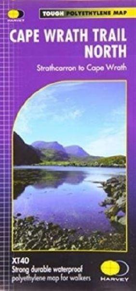
Cape Wrath Trail is a challenging route from Fort William to Cape Wrath. It is around 200 miles long and passes through some of Scotland's wildest and most spectacular scenery. The trail has evolved from use and is not an officially recognised National Trail. There is no single definitive route. There are various ways of tackling the traverse all of which are highlighted on the maps leaving the actual route choice to the individual walker. This is rough country not to be underestimated. Some sections of the route will require an overnight stop in the mountains. This will either have to be wild camping or the use of a bothy. South covers Fort William to Strathcarron and North covers Strathcarron to Cape Wrath. XT40 New generation of tough polyethylene maps. The HARVEY series of Long Distance Route maps is an established success. Now the advanced technology used in the creation of our best-selling British Mountain Maps is also applied to the route maps. These maps are a leap forward in technical excellence. They are tough, durable, light and 100% waterproof virtually indestructible in normal use. They are light to carry, and compact not the great bulky package you get with a laminated map. The maps are detailed, with the routes clearly marked. They also contain general information, useful telephone numbers and a full key. Main points at a glance. Detailed, clear and easy to read. Printed on tough 100% waterproof, tearproof paper. Light to carry less than half the weight of a laminated map.Good value whole route on two maps. Information on accommodation and services.
| Reihe | Trail Map XT40 |
|---|---|
| Themen | Lifestyle, Hobbys und Freizeit Reisen und Urlaub Landkarten und Atlanten Reise- und Freizeitkarten |
| ISBN | 9781851375332 |
| Sprache | Englisch |
| Erscheinungsdatum | 28.06.2019 |
| Größe | 247 x 128 mm |
| Verlag | Harvey Map Services Ltd |
| Lieferzeit | Lieferung innerhalb von 28 Werktagen |
| Herstellerangaben | Anzeigen Libri GmbH Europaallee 1 | D-36244 Bad Hersfeld gpsr@libri.de |
Wie gefällt Ihnen unser Shop?
