GUTSCHEIN
Bitte haben Sie einen Moment Geduld, wir legen Ihr Produkt in den Warenkorb.
Diese Produkte könnten Sie auch interessieren:
Bitte haben Sie einen Moment Geduld, wir legen Ihr Produkt in den Warenkorb.
| Reihe | Independently published |
|---|---|
| ISBN | 9798173940902 |
| Sprache | Englisch |
| Erscheinungsdatum | 18.09.2026 |
| Größe | 279 x 216 mm |
| Verlag | Independently published |
| Lieferzeit | Lieferung in 7-14 Werktagen |
| Herstellerangaben | Anzeigen Libri GmbH Europaallee 1 | D-36244 Bad Hersfeld gpsr@libri.de |
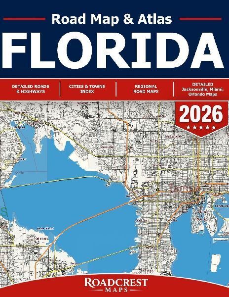
Florida Road Map & Atlas 2026From the Panhandle and Gulf Coast to Orlando, Miami, the Everglades, and the Florida Keys - explore the Sunshine State beyond the next turn.The Florida Road Map & Atlas 2026 by Roadcrest Maps is designed for travelers who want more than a navigation app can show on one screen. Whether you're planning a Florida road trip, heading to the beach, exploring a new city, traveling by RV, or simply want a dependable printed map in your vehicle, this atlas gives you a detailed, big-picture view of the roads and destinations around you.From Panama City and Florida's Gulf communities to Jacksonville, Orlando, Tampa Bay, Fort Lauderdale, Miami, Naples, Everglades City, and Key Largo, the atlas provides extensive mapping of highways, major and local roads, cities, suburbs, smaller communities, waterways, coastal destinations, and rural areas throughout Florida.Explore Florida in greater detail- Extensive statewide road coverage for highways, local roads, urban areas, smaller communities, coastal routes, lakes, waterways, and regional destinations.- Explore South Florida in exceptional detail, including Miami, Miami Beach, Coral Gables, Hialeah, Doral, Pembroke Pines, Hollywood, Fort Lauderdale, Boca Raton, Delray Beach, and surrounding communities.- Navigate Central Florida and Orlando, including Orlando, Maitland, Winter Park, Eatonville, surrounding neighborhoods, major roads, expressways, and numerous lakes.- Follow Florida's Gulf Coast, with coverage around Naples, Bonita Springs, Marco Island, St. Petersburg, Saint Pete Beach, Treasure Island, and surrounding coastal communities.- Go beyond the cities into the Everglades and Ten Thousand Islands, including Everglades City, Chokoloskee, Shark Valley, Ochopee, Marco Island, and remote South Florida landscapes.- Continue south toward the Florida Keys, with mapping around North Key Largo, Key Largo, coastal islands, waterways, and the Overseas Highway corridor.- Detailed Northeast Florida mapping includes Jacksonville, Orange Park, Mandarin, San Jose, Baymeadows, and surrounding areas.Perfect for Florida vacations, beach trips, family road trips, snowbird travel, RV adventures, relocation planning, everyday driving, and anyone who wants a reliable printed navigation backup alongside GPS.A navigation app can get you to the destination. A printed atlas helps you see the beaches, cities, back roads, islands, lakes, and unexpected places worth discovering along the way.Panhandle. Gulf Coast. Atlantic Coast. Everglades. Keys. One atlas for exploring Florida your way.
| Reihe | Independently published |
|---|---|
| ISBN | 9798173940902 |
| Sprache | Englisch |
| Erscheinungsdatum | 18.09.2026 |
| Größe | 279 x 216 mm |
| Verlag | Independently published |
| Lieferzeit | Lieferung in 7-14 Werktagen |
| Herstellerangaben | Anzeigen Libri GmbH Europaallee 1 | D-36244 Bad Hersfeld gpsr@libri.de |
Wie gefällt Ihnen unser Shop?
